Saturday, May 30, 2015

Mt. Cabot, Berlin, NH. 5/30/15

Somewhere around 12 years ago my friend and old college roommate unsuccessfully attempted to hike Mt. Cabot twice.  However, we were lucky enough to see 3 moose and to camp at the remote Unknown Pond campsite during those trips which have made for a couple great hiking stories.  I made a third solo trip to Mt. Cabot and managed to summit it myself.  It had been so long since I had been up there and I was looking forward to the two day one night trip Kyle and I had planned.  Because the area is so far from home, the plan was to do a 10+ mile hike to Mt. Cabot, The Horn and The Buldge on Saturday, camp out, and hike Mt. Starr Kind and Mt. Waumbek on Sunday.  Rain was in the forecast for Saturday afternoon, but we were hoping we would dodge it.

It was the same morning drill before a hike.  Up at 4 AM meet Kyle at 5, long drive up 93 to White Mt. Bagel for a breakfast sandwich.  Usually once we hit Franconia Notch the ride becomes a little less drab and mountain fever kicks in, but this time we had another hour to go.  We took Route 3 to 115, to route 2 and then route 16 through Berlin.  Once we passed Berlin, NH we saw our first moose on route 110.  Unfortunately it was a dead one on the side of the road.   Somewhere around 8:45 we reached the Berlin Fish Hatchery gate which supposedly closed and locked by 4PM.  The lock looked like it was covered in spider webs and hadn’t been opened in years, but it still gave me a little anxiety in the early goings of the hike about making it back in time.  We drove all the way to the end of the dirt road to park, gear up and swat at the bugs.

Kyle gearing up
We followed the Bunnell Notch Trail for 2.3 miles to the Kilkenney Ridge Trail.  The trail was overgrown at the beginning but easy to follow with some moderate inclines. 

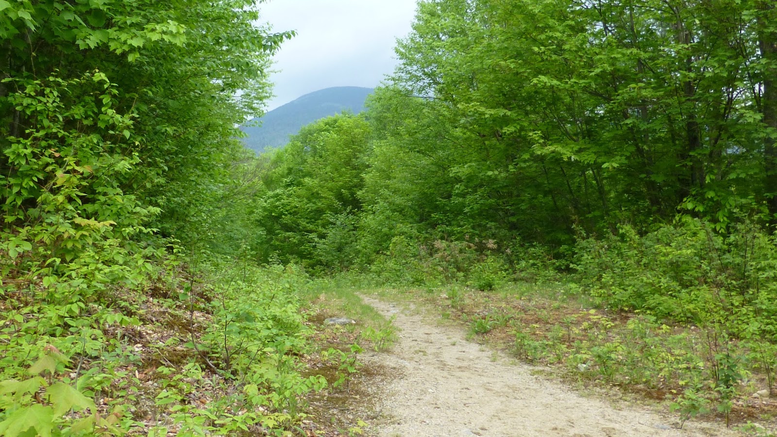
Our first view of Mt. Cabot from the trail
One of many trillium found on Bunnell Notch Trail
Once we reached the Kilkenney Ridge Trail, we saw the first hikers of the day while following some switchbacks up to Cabot.  At Bunnell Rock we ran into the rest of the hikers group who were taking in the view.
View from Bunnell Rock
More views from Bunnell Rock
At about 11:00 we reached the Cabot Cabin.  It was as creepy as I remembered.   The 2 couples we ran into at Bunnell Rock and their dog showed up and ended up taking over the cabin when they closed the door behind them.  Maybe those girls were the braless hippies who wash in the river that the guy on the Moosilauke was talking about?  We were done checking out the cabin anyway so off we went.  

Cabot Cabin
Cabot Cabin kitchen area
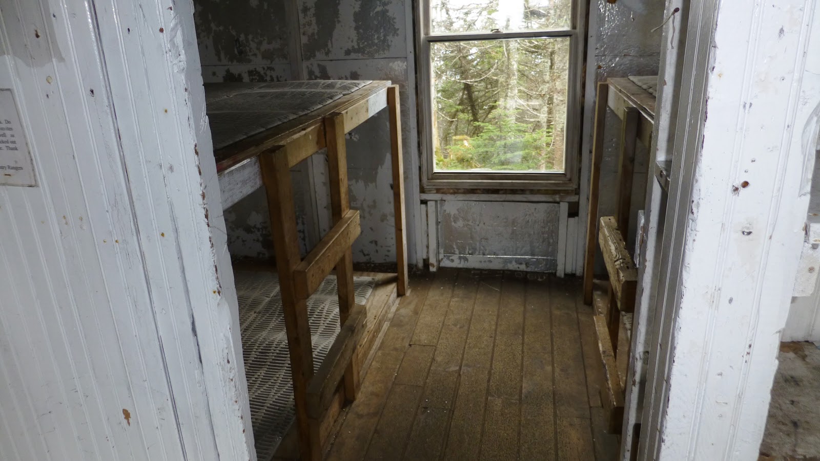
Cabot Cabin sleeping quarters
In about two hundred feet or so we reached the Cabot summit.  We ran into a mother daughter group of 4, one of whom told us “You’re almost there” and I was like “almost where?”  Come to find out the summit ended up being ahead of us and we stopped for Kyle’s obligatory photo.
We followed Kilkenney Ridge Trail right past the Horn.  We lost significant elevation and then gained it all back as we headed to the Bulge and that’s where things got a little crappy.  Moose crap that is!  There were moose dropping all the way up to the boulders which make up the Bulge.  We had to do a little bit of maneuvering through the boulders to get what were the best views of the day.  It was really windy up there (40-50 mph gusts?) but the weather had only gotten better since we started in the AM.

Fiddleheads on the trail.  You can cook these things!
Moose poop!  You shouldn't eat these LOL!
Looking back at The Horn and Mt. Cabot from The Bulge
Southerly view from The Bulge towards the Presidential Range
After taking a long break (for us), we started making our way down to Unknown Pond.  I couldn’t wait to get down there and take a look at the campsite I camped at so many years ago.  Kyle took off down the trail and I leisurely made my way down to the pond.   I made a quick stop at the pond to take a couple of pictures in anticipation of hanging out at the old campsite by the pond.  Unfortunately there were no signs of the campsite because the area was completely different than I remembered it.  I left the pond feeling a little disappointed that I didn't get to see this old memory in person.
A weathered bog bridge on the Kilkenney Ridge Trail
The Bulge from Unkown Pond
After the pond we continued on Unknown Pond Trail back to the car.  Before the hike I was hoping to see the part of the trail where I crossed paths with a moose during one of my previous trips, but that all seemed doubtful after seeing the changes at the pond.  Once again Kyle took off and I took my time looking for that spot.
Lady Slippers on the Unknown Pond Trail
This reminds me of the spot where I ran into the moose on the trail.  Could it be?
This feeding butterfly wouldn't keep still enough for a photo.  But I saw lots of butterflies on this hike
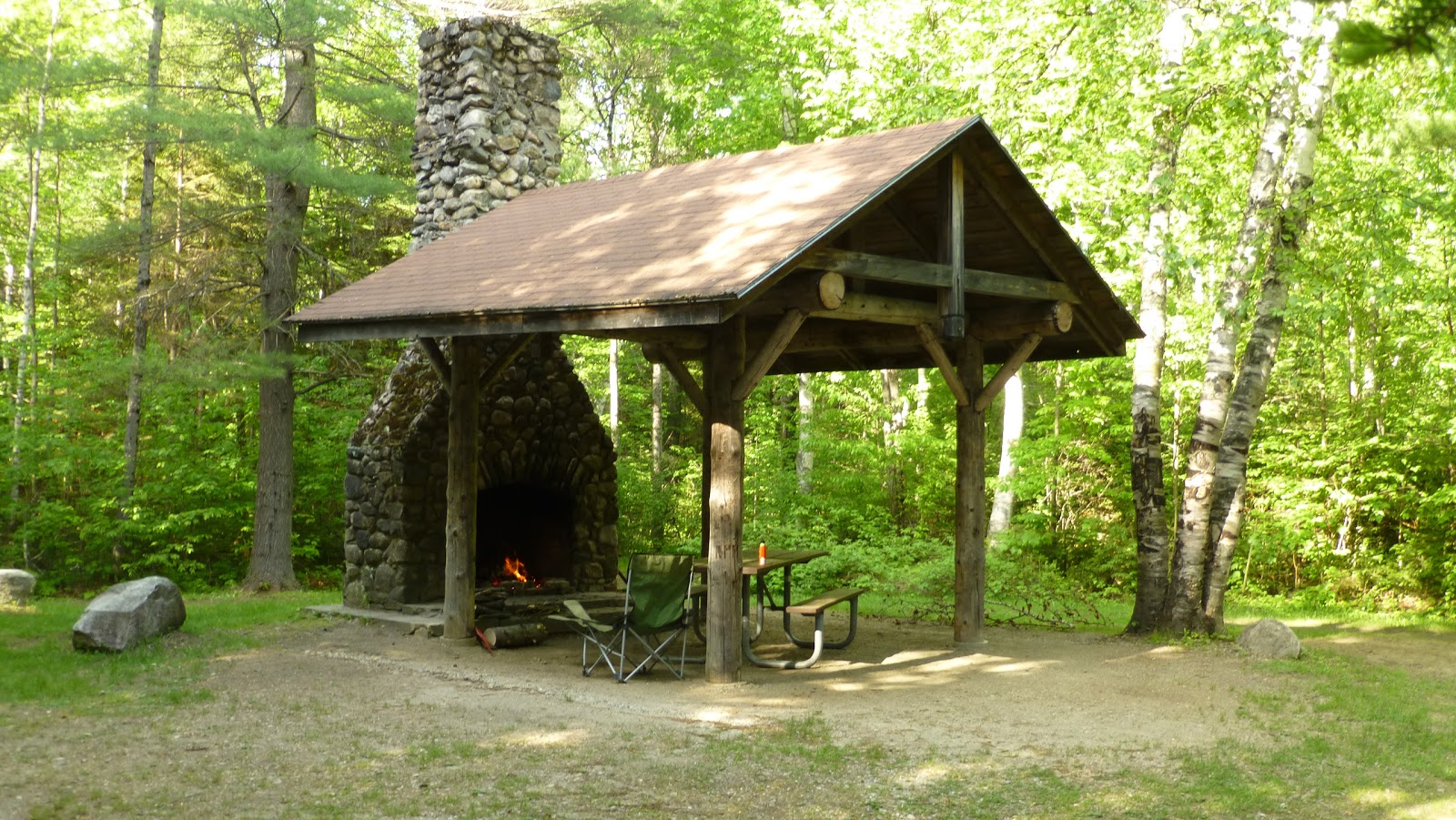
We made it back to the car by 2:45 and started making our way to Moose Brook State Forest to check into our campsite.  The campsite manager was a bit of a character.  He got into talking about the bears in the park and how he had used an M-80 gun to scare off a bear that was trying to get into the dumpster.  He said he shot the ¼ stick of dynamite and it went right through the bears legs and when it went off the bear bolted off into the woods not looking back.  He then went and rubbed two pounds of cayenne pepper on the dumpster to deter the bear when it came back.  Our campsite had a roof with a standing chimney fireplace.  We both worked on cutting up a fallen pine tree to make firewood.  I spent the rest of the sunny afternoon checking out the park, drinking a couple of beers and working on getting a giant fire while Kyle called some girls and searched for some local teens on Tinder from his camp chair.  The great outdoors!
Moose Brook State Park Headquarters
"The Shelter" campsite
Our fire.
My Inferno!
I think it was about 9:00 when we got into our tents and soon after that we heard a rumble like a freight train was coming toward us.  It was rain and wind.  But not only was it rain and wind, thunder and lightning came with it and that doesn’t make for a good time when your laying in a tent held together with aluminum poles.  I was legitimately scared for a while and needless to say didn’t get much sleep that night.  Maybe a couple hours sleep all night.

That morning we woke up to a light rain.  Everything was soaked and I wasn’t really up for hiking Mt. Waumbek in the rain so we both decided to head home.  And off we went.

The damp morning.
I wore a GPS watch I got for Christmas from Leah.  I didn't realize the heart monitor wasn't on until a couple miles in:


Monday, April 20, 2015

Tecumseh 3/21/15

For the first Hike of 2015 and for the third year in a row we are hiking on the first weekend of the spring.  Two years I hiked North Hancock and thought that I would never hike in winter conditions again.  Last year we hiked a 17 mile round trip hike to Owl's Head.  Maybe we've learned our lesson because this year we decided to hike Mt. Tecumseh the lowest of the 4,000 footers and one on Kyle's list for 48.  It was good to get outside for the day after being snowbound in the house for nearly a month.
Kyle bare booting it up the trail.  Those damn post holers!
View of the Tripyramids in the distance from a ski trail outlook 
View from Tecumseh Summit.
Kyle enjoying a snack and a view.
Clouds rolling in and a good time to get off the mountain.
Glissading better known as the butt slide 

Snow covered Kyle adjusting his pack after "glissading" down the mountain.
We finished the Tecumseh hike around 1:00 and had plenty of time to fit in another "lesser" hike.  We drove about 5 minutes to the Livermore Road parking lot.  We took the Greeley Pond Trail to Goodrich Rock Trail.  On the way we had to hike through the Davis Boulders.  The trail was broken out to the boulder field, but Kyle followed coincidentally some type of cat path and we post holed to Goodrich Rock.

Tecumseh summit from the Livermore parking lot.
Kyle following the trail blazes through one of Davis' boulders.
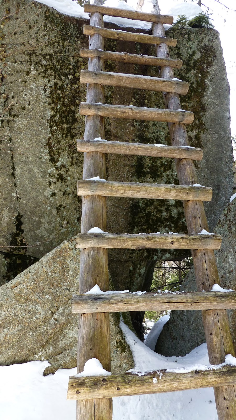
Ladder to get to the top of Goodrich Rock
Waterville valley and Sandwich Mountain from Goodrich Rock.

Thursday, September 25, 2014

Playing Hooky with the Moose 9/25/14

What better way to escape the misery of the a 40 hour week than by calling in sick and getting paid to hike?!  Because just like fishing, a bad day of hiking is better than a good day at work.  But this wasn't going to be a bad day of hiking.  After accomplishing the brutal one-day Presidential traverse all other hikes will be measured by that.  I studied the route for this hike but never looked into the mileage or times as I usually do. There was a major storm coming from the south that was supposed to drench Mass and RI, but a high pressure system was sitting over northern NH keeping the rain at bay.  Kyle and I went through the usual meetup routine and headed to Mt. Moosilauke to summit it and all the sub peaks including Mt. Jim, Mt. Blue and the South Peak.

Mt. Moosilauke is the most western and maybe most southern 4,000 foot peak in the White Mountains and to get there we took route 93 to 112 West to route 118 South.  This was new territory for us.  Route 118 was a windy hilly mountain road and it seemed to take forever to get to Ravine Road which was where the trail head started.  Once we reached the unpaved Ravine Road we took it all the way to the end where the Dartmouth College run Moosilauke Ravine Lodge is located.  It was in the low 50’s as we began to prep what little gear we were going to carry for this trip.  All I had in my pack was a days worth of food, my first aid kit and 70 oz. camelbak.  As we were getting ready another hiker was  putting on his bright orange hunting mittens and said to us “It stinks to have to wear gloves already”.  I innocently replied to him something like “It’s not that cold” and he seemed to throw me a look of death.

Our boots hit the Ridge Trail before 8:00.  The trail was easy to follow even though there weren't many (if any?) trail blazes to follow.  We crossed some of the nicest bridges I've ever encountered in the White Mountains.  I felt as though my Camelbak bladder was leaking, so I eventually removed the tubing and only used the reservoir.  Doing this made me realize that my wet back is probably a combination of a dribbling bladder but more so of an overly sweaty back.  Anyway, the ridge trail passes directly over Mt. Jim.  I found a small herd path which ended up being just that so we assume we did summit Jim.  After about an hour and a half of hiking we reached the Beaver Brook trail junction.

First Foot Bridge we encountered on the Ridge Trail
2nd Bridge
Some mushrooms nestled in a bed of sphagnum moss.
Bright Red Capped Mushroom growing on the trunk of a tree.
On Beaver Brook Trail there was supposed to be a herd path that led to Mt. Blue and when we reached the area where we though it would be, we started keeping an eye out for the path.  At one point I noticed some survey marker tape leading up and started what would have been a gnarly bush whack through some thick trees and brush.  That wasn't the way to Blue.  As we moved along, Kyle noticed a stuffed animal off the trail and in the woods.  I grabbed it and contemplated bringing it home to Kayla and Emma, but thought it would be better off left in the woods.  I placed it on a rock hoping he would bring a couple of laughs or scares to more hikers later on in the coming days.

Stuffed albino squirrel holding a nut we found off the trail and I placed on this rock.
Squirrel watching us walk away and wondering why we weren't taking him home.
Jungle of moss, leichin and mushrooms growing on a log.
After I had all but given up on hiking up to Mt. Blue, Kyle turned a corner and said here it is.  A short tiny cairn was at the junction of the herd path.  This was no bush whack and was more of a foot path.  The path went through a pine forest and was really soft and nice to walk on.  There were animal paths all over this area and I saw a pretty big bear footprint pressed in on the hiking trail along with a few moose footprints.  Mt. Blue is a mountain on a list called Trailrights 72 and a summit log is supposed to be hanging from a tree somewhere.  All that was there was a ripped plastic bag that was probably brought there by the bear with the giant paw.  Bummer because I was looking to sign this log.

Cairn marking the herd path to Mt. Blue.
Herd Path up to Mt. Blue.
Mt. Blue summit.  You can make out the bag left by Paws the bear in the middle of the picture.
After a few minutes on Blue, we kept moving and as we were getting closer to the treeline to the summit of Moosilauke, I thought I heard an animal running away up ahead and when I heard Kyle yell "Whoa", I thought for sure he came across a moose on the path.  Once I caught up to him to find out what was going on, he pointed out the Spruce Grouse that was hanging out on the the trail and had flew up into the trees.  I took a few pictures of him and kept trying to get closer .  My camera must have been a couple of feet from him.  He was definitely less scared than I was!

Curious and brave Spruce Grouse just hanging out just before tree line.
Another angle of the Spruce Grouse.  If it weren't for that red eye he'd blend into the tree nicely.
The summit was like a battle field, there were stones everywhere piled up to block the wind as Moosilauke is notorious for bad weather conditions.  We were lucky we didn't have to use them today.  We had to be the first hikers to the summit today and were the only ones up there until we were joined by the guy with the orange hunters mittens who happened to be named Jim.  While on the summit we traded hiking stories with Jim.  He was an interesting guy who happened to mention all the bra-less women he saw on the Welch Dickey Loop hike and the naked hut girls bathing in a river.  Kyle and I probably never noticed these girls because we were probably hiking too fast!  He followed us down Moosilauke and I talked with him the entire way down.  Once we reached the junction of the spur path to South Peak we split up.  But not before Kyle asked him about the wooden cross on his neck.  Jim said he stole it from his daughter because his "fat whore adultering wife" gave him a silver cross and he refused to wear it.  That had Kyle and I chuckling most of the way up to the South Peak.

 Final uphill towards the summit above treeline.
Kyle getting set to hunker down in the bunker like summit.
Northeasterly view just above treeline to White Mountain National Forest.  (200 ISO)
Wider view of White Mountain National Forest.
Looking West towards Mt. Clough and Blueberry Mountain.
Franconia Ridge from summit (200 ISO).
Zooming in on the hiker (not Jim) we left on the summit from South Peak.
After a few minutes on the South Peak we backtracked to the Carriage Road to get off the mountain.  From the Carriage Road we took the snapper trail.  The road and trail were brutal on my knees.  I should have used my hiking poles on the way down but for some reason I didn't.  I was so tired at one point that I wanted to sit down but I told myself "why are you going to sit down when you'll be sitting for 2.5 hours in the car on the way home."

Carriage Road.
Blue Bead Lilly.  While looking to find out what this actually was I learned that Native Americans used these berries to treat injuries and bruises.
When we finally got down the mountain we hit a spider web of trails that was pretty confusing.  We used our best judgments to choose the right trail which led us right by the Moosilauke Ravine Lodge.  There were 2 bunk houses along with the lodge.  On the deck of the lodge there were some college kids eating and 2 others were building a new giant structure.  I had to take a peak inside the lodge.  We were done at around 1:00 and were contemplating trying another hike.  I stopped in at a General Store in North Woodstock for a chocolate milk hoping it would help me recover a little.  But, it didn't and we decided to head home.  I wanted to pull into a parking lot to change out of my hiking boots and in the process I nicked my tire causing a bubble to form.  Kyle looked up what the bubble was online and read something that the tire could blow out at high speeds, so we took it relatively slower than usual making a couple of stops to check on the tire.  We made it home and I'm in the process of replacing the tire.  Great day, great hike.