Showing posts with label Lonesome Lake. Show all posts

Saturday, July 27, 2013

Cannon Balls! 7/27/13

On July 27, I set out for another hike with the Random Group of hikers.  The plan for this hike was to hike almost 12.5 miles up to Cannon Mountain over the 3 Cannon balls and to North and South Kinsman Mountains.  

I drove up by myself this time and left West Boylston at 5:30 which would get me to the Lonesome Lake trail head in the Lafayette Place parking lot well before the group was scheduled to start at 8:30. The forecast for the day was to be clear with temperatures on the summits to reach around 60 degrees. When I got to the trail head parking lot Mike who I had seen up on Tecumseh and the Osceolas pulled into the lot.  I went over to say hi and he told me that he was only planning on hiking Cannon on this day and coming back in two weeks to bag the Kinsmans.  On the way back to the car I ran into Lisa who was hiking with the group and at about 8:45 Ted, the group leader pulled in with the rest of the radomites.

We started our hike on the Lonesome Lake Trail which led us by some campsites at the Lafayette campground and soon we were quickly at the junction of the Hi-Cannon Trail.  The Hi-Cannon trail was steep and followed switchbacks for most of the way up.  Ledges off the trail offered views of the Franconia Ridge, Rte. 93 looking Southbound, and Lonesome Lake.  Also on the Hi-Cannon trail were 2 sets of weathered ladders made of 2 x 4's which made for some fun climbing on the way up.  At the top of Cannon there was a fire tower which offered 360 degree views.  There were lots of people on the top of Cannon most of which took the tram up.

Franconia Ridge from outlook on Hi Cannon trail.
The longer of the two ladders on Hi-Cannon trail.
Lonesome Lake from scenic overlook.
Through the pines on the Hi Cannon Trail.
View of the Cannon balls and North and South Kinsman (our upcoming route) from the observation tower.
Never ending northwesterly view from the Cannon observation tower.
The group from left to Right (Me, Lisa, Delphine, Ted, Debra and Ricardo)
When we all finished our snacks and were done taking in the views, we took off on the Kinsman Ridge and towards the Cannon balls.  The descent down Cannon was brutally steep.  I took out my hiking poles at this section of the hike and ended up never putting them away again.  At one point Lisa fell on the trail and scraped the underside of her arm up pretty good which would ultimately lead to her bailing out before summiting the Kinsmans.  Ted also drew some blood on his leg and I found a couple cuts and nicks later on in the hike which must have happened on this portion of the trail.  There were plenty of people on the trail who had camped out at Lafayette place and decided to go on a day hike who were having a wicked time getting down this section of the trail.  According to our estimation, it had taken us almost an hour to go 0.5 miles!  The Cannon balls may have been the toughest part of this hike as they seemingly kept coming at us.  And once we were finished with the them, there was still one more "hump" as described in the AMC guidebook that we had to go over before the ascent to North Kinsman.

Distant view from first Cannon ball of steep section of Kinsman Trail with observation tower at top left.
Another ladder on Kinsman Ridge Trail.
When we finally reached the Fishing Jimmy Trailhead junction at about 3:00, I ran over to Kinsman Pond to see if I could grab any drinking water to fill my empty Camelbak as well as my 1 liter Nalgene.  I had almost run out of water on the Cannon balls and was rationing it along the way.  I found a trail sign which pointed to water and it seemed as though the drinking water was to be drawn from the pond.  No way I was drinking that with only a filter, so I ran back to the group and we said goodbye to Lisa and headed up to North Kinsman.  The view on the ledge near the peak of North Kinsman was even better than I had remembered it.  And since we had just come all the way from Cannon, it was good to see the route we accomplished this far.  But, we didn't stay long because we were already behind schedule and headed over toward South Kinsman to take in some more views.  We kept comparing the hike to the Cannon balls which made this portion of the hike seem like a piece of cake.

Franconia Ridge and Lonesome Lake from a rock outcrop near North Kinsman Peak
Southerly view from South Kinsman towards North Kinsman on the left and Cannon on the right.

The cairn marking the top of South Kinsman with Ricardo holding it up.
Once we descended the Kinsmans we stopped to take a break at the Fishing Jimmy/Kinsman Pond trail junction.  I was dreading this portion of the hike because I remember the last time heading down the F'ing Jimmy trail in September, it was steep and long.  Well the trail was still steep and long!  After hiking for a while you expect to see the Lonesome Lake hut around the next corner or after climbing every hill but it doesn't.  Part of it is fatigue and another part of is that damn F'ing Jimmy Trail!  This time it didn't help that I was out of water too!  When we finally got to the hut it was almost 7:00.  Dinner was being served to the guests and I made a b-line straight to the drinking water faucet in the kitchen.  We hung out for a while taking in more views of Franconia Ridge and it's reflection on Lonesome Lake.  We took off for the last mile to our cars and again the trail seemed much longer than it was.  When we finally got to Lafayette Campground, I took a few minutes to use the bathroom to wash up instead of driving home with my calves covered in mud.  I finally started my car at 8:00 and got home at 10:30.

A peaceful Lonesome Lake reflecting the Franconia Ridge.
The daunting steep trough from Cannon to the first Cannon ball.

Sunday, September 23, 2012

North and South Kinsman Mountains 9/22/12

On Saturday September 22, 2012, I met up with a coworker at my office in Hudson, MA at 5:00 AM for the 2.5 hour drive to the trail head in Franconia Notch State Park in New Hampshire.  It was dark and drizzly when we left and we began questioning the weather reports.  Once we got to NH, the drizzle seemed to subside to a heavy fog.  It was so foggy that on the way up we saw emergency response vehicles around the Plymouth area.  It looked like an F-250 had went off the highway and took out about 50 feet of guardrail.  We wondered if he was avoiding a moose.

We arrived at The Basin parking lot at about 7:30 and headed out on the Basin Cascade Trail at about 8:00 in the fog.  It was about 45 degrees and we could feel the chill in our fingers.  The waterfalls I read about on the trail lived up to my expectations.

Kinsman Falls
Rocky Glenn Falls
We followed the Basin Cascade Trail for 1 mile to the Cascade Brook Trail which obviously followed Cascade Brook.  There were a couple of river crossings on the Cascade Brook Trail one of which was the result of a washed out bridge which we were told was only about 3 years old before it was cleared out by the rushing waters of Cascade Brook.  We stayed on Cascade brook for 2 miles until we came to the junction of the Kinsman Pond Trail.

A very mossy Kinsman Pond Trail
Kinsman Pond Trail was smooth and seemed to follow a logging road for a good stretch, but that changed quickly.  The trail turned to the north and followed a mossy brook which we cautiously followed to to Kinsman Pond.  It felt at times we were hiking in the pacific Northwest.  It was still foggy but we occasionally noticed the brightening of the skies with the sun trying to burn it's way through the clouds.   It was a long stretch and the footing was tricky.  We were making excellent time and saw one person on the way to the pond.

A socked in Kinsman Pond
We finally made it to a foggy Kinsman Pond at about 9:30.  With the fog, wind whipping and small waves crashing near the rocks on the edges of the pond, it felt we were walking near the ocean.   We took a break at the Kinsman Pond Shelter where we met some through hikers who seemed to have stalled out at the Kinsman Pond Shelter.  They said they started at Mt. Katahdin but had been making their home at the Kinsman Pond Shelter for about 3 weeks.  They didn't know which day it was.  They were rather odd and their stories didn't make sense and we later referred to them as Mountain Hobos.  After about a 20 minute break we continued on and reached the Kinsman Ridge Trail.  This is where we met up with Kate a nurse from Scarborough, ME who had a unsettling encounter with the mountain hobos.  She asked us if she could tag along with us and we obliged.  We followed the Kinsman Ridge Trail in the fog and saw more and more patches of blue skies on the way up the sometimes steep rocky trail. 

Undercast in Franconia Notch
When we reached the North Kinsman Summit at about 10:45 it was wooded and didn't offer much of a view.  But a spur trial led to a cliff and we were then awestruck by the view of Franconia Ridge from above the clouds.  The fog we had been walking through was actually a cloud which was trapped in the notch.  The wind was whipping which was causing the thick milky clouds to move north like an ocean.
 
North Kinsman from South Kinsman
The three of us continued on to South Kinsman which was a rocky descent and climb to the summit which had 360 degree views of the area.  Looking back at North Kinsman was rewarding because we busted hump to get to the south summit. While we were on the South summit I checked the AMC White Mountain Guide which described the peak of the North Summit as actually being a pointy boulder just off the trail.  After about a 20 minute break we trekked back to the North Summit.

Clouds subside making a clear view of Franconia ridge
When we arrived back at the North Summit the clouds had broken and provided clear views of the entire valley with Lonesome Lake nestled in the middle of it.  We located the pointy boulder right off of the trail and each climbed to the top of it.

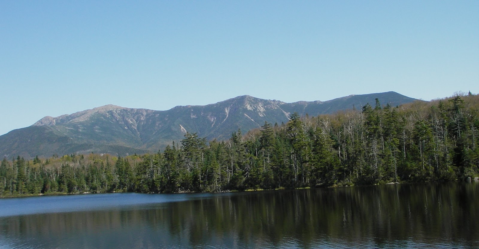
Franconia Ridge from Lonesome Lake Beach
Our next destination was Lonesome Lake.  We followed Kinsman Ridge Trail to the Fishin Jimmy Trail to get there for 2.1 miles.  The trail was steep at times and required some long striding steps on boulders which pounded the bottoms of my feet.  The footing was a little tricky and I slipped a couple of times but not enough to make me stop.  It must have been about 12:30 when we started noticing the trails starting to get busy with other hikers. 

North and South Kinsman behind a greasy thumb print
When we arrived at Lonesome Lake at about 1:45-2:00 it was crowded with sight seers.  After about a :30 break at Lonesome Lake, we separated ways with Kate and headed to what we thought was the way to Cascade Brook Trail.  A group of about 20 college kids halted us at a footbridge and some little kid with a bell strapped to his backpack threw our bearings off and we headed to the south of the Lake.  When we arrived at a trail junction we realized it was not the way we were supposed to go.  But I did manage to grab a shot of the accomplished North and South Kinsman with my greasy lens.

When we finally reached the Cascade Brook trail head we were off again and motoring down the trail.  The trail was rather easy compared to the Fishn Jimmy trail and were were able to maintain our quick pace.  We stopped again for more views of the waterfalls and made it back to the car at 3:45.