This was a monster hike and if I told you I thought it would
be a piece of hike, I was lying. I left West Boylston at about 4:00 and met Kyle at the Hudson park and ride at 4:30.
I’ve never seen 495 so quiet on this ride up. I think it was somewhere before Concord, NH that we saw a shooting star which was perfect because I wished for a safe and
rewarding hike so I could get back to my family unscathed.
We arrived at the Lincoln Woods parking lot at about 7:00 after
stopping at White Mountain Bagel Company for breakfast sandwiches. Because of the government shutdown, there was
a sign on the welcome board that no parking fee was required. There was a heavy overcast, but the weather
report called for clearing skies around 11:00. There were quite a few vehicles already in
the lot and our boots hit a leafy and flat Lincoln Woods Trail at 7:11 and reached the
Bondcliff Trail at 8:30.
The first couple of miles of the Bondcliff trail was on an old railroad bed, but as we started gaining elevation we found ourselves in the clouds. There were lots of leaves covering some smooth rocks on the trail which made for an occasional foot slip and one section of the trail was a little muddy, but overall the trail was in great shape. We ran into about 7 people heading down the trail and every one of them said we
have sunshine and incredible views ahead of us. If we ran into another 20 people and they told us the same thing, I wouldn't be sick of it. We also saw a couple of
campsites abutting the trail along the way.
When
we reached a short escarpment on the trail, we were finally out of the clouds
and the view over to the Franconia Ridge was awesome. We were up above the clouds for a while on
the cliffs and stopped to enjoy them and take the obligatory cliff photo shot.
As
we headed over to Mt Bond, we went back into the clouds. It was a surreal feeling hiking in the thick "fog" and following the cairns to stay on the trail. What a surreal feeling it was hiking in the cloud and relying on the cairns to figure out where the path was leading us. We reached Mt. Bond at 11:45 and stopped for another break and more photos.
The spur trail over to West Bond had a significant drop and gain in elevation and we reached the peak at 12:30. We took another break and enjoyed the views. At this point the cliffs were being completely submerged in the clouds.
We headed back to Mt. Bond and I took a break to swap out my socks and I put my camera away in preparation of the hike down.
We really didn't take another break until we reached a small watering hole at Black Brook on Bondcilff Trail. I busted out the old PUR filter and grabbed a couple of liters. We trudged on in what felt at times like a drunken stupor until our next break at the footbridge over the Pemi. We reached our car at about 5:30 after passing several groups of people who seemed to be predominantly from India...
Lincoln Woods Trail: 2.9 miles
Bondcliff Trail: 7.9 miles
West Bond Spur: 1.0 miles
Bondcliff Trail: 7.9 miles
Lincoln Woods Trail: 2.9 miles
Total Miles: 22.6
Approximate Time: 10:15
Total Elevation Gain: 4,800 feet
 |
| Franconia Brook footbridge |
 |
| Railroad track at the beginning of Bondcliff Trail |
 |
| Leafy Bondcliff Trail with some last bits of foliage |
 |
| Misty Mountain Hop |
 |
| Kyle in the clouds with his iPhone |
 |
| Up and at'em over the Bondcliff escarpment |
 |
| First view of Franconia Ridge with Owls Head poking up |
 |
| Bondcliffs in the clouds |
 |
| Rainbow halo |
 |
| Hikers on the cliffs |
 |
| Kyle on the cliff |
 |
 |
| Me on the cliff |
 |
| In the clouds on the Bondcliff Trail headed to Mt. Bond |
 |
| There's the cairn |
 |
| Bondcliffs from Mt. Bond |
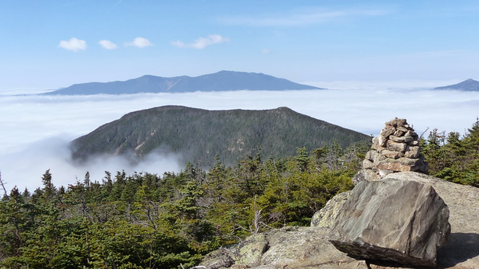 |
| West Bond from Mt. Bond with the Franconia Ridge in the background |
 |
| Presidential Range from Mt. Bond |
 |
| Mt. Bond from West Bond |
 |
| Bondcliff being swallowed by the clouds |
 |
| Couldn't get enough of the Franconia Ridge (Those clouds above didn't move all day!) |
 |
| Carrigain and Osceola from West Bond... I think... |
 |
| Twins from West Bond |
 |
| Looking back at West Bond and Franconia Ridge |
 |
| Liberty and Flume with Moosilauke in the back from Mt. Bond |
 |
| Looking north towards the Twins and Mt. Guyot |
Lincoln Woods Trail: 2.9 miles
Bondcliff Trail: 7.9 miles
West Bond Spur: 1.0 miles
Bondcliff Trail: 7.9 miles
Lincoln Woods Trail: 2.9 miles
Total Miles: 22.6
Approximate Time: 10:15
Total Elevation Gain: 4,800 feet